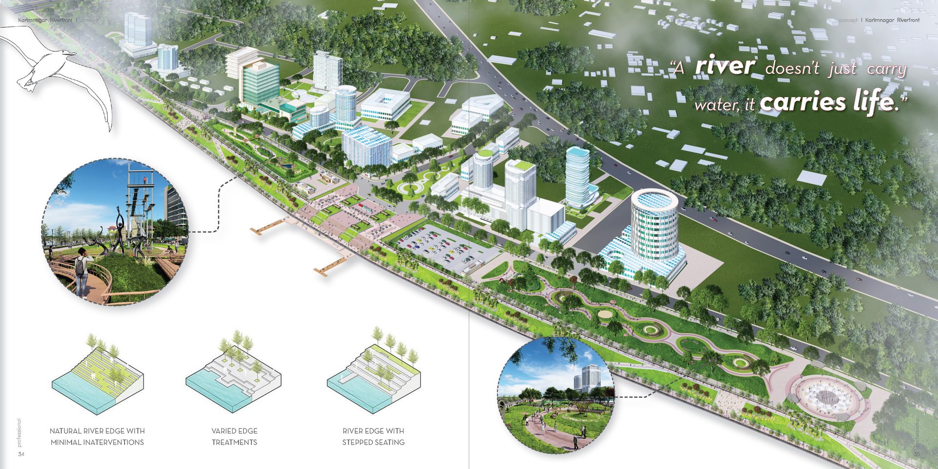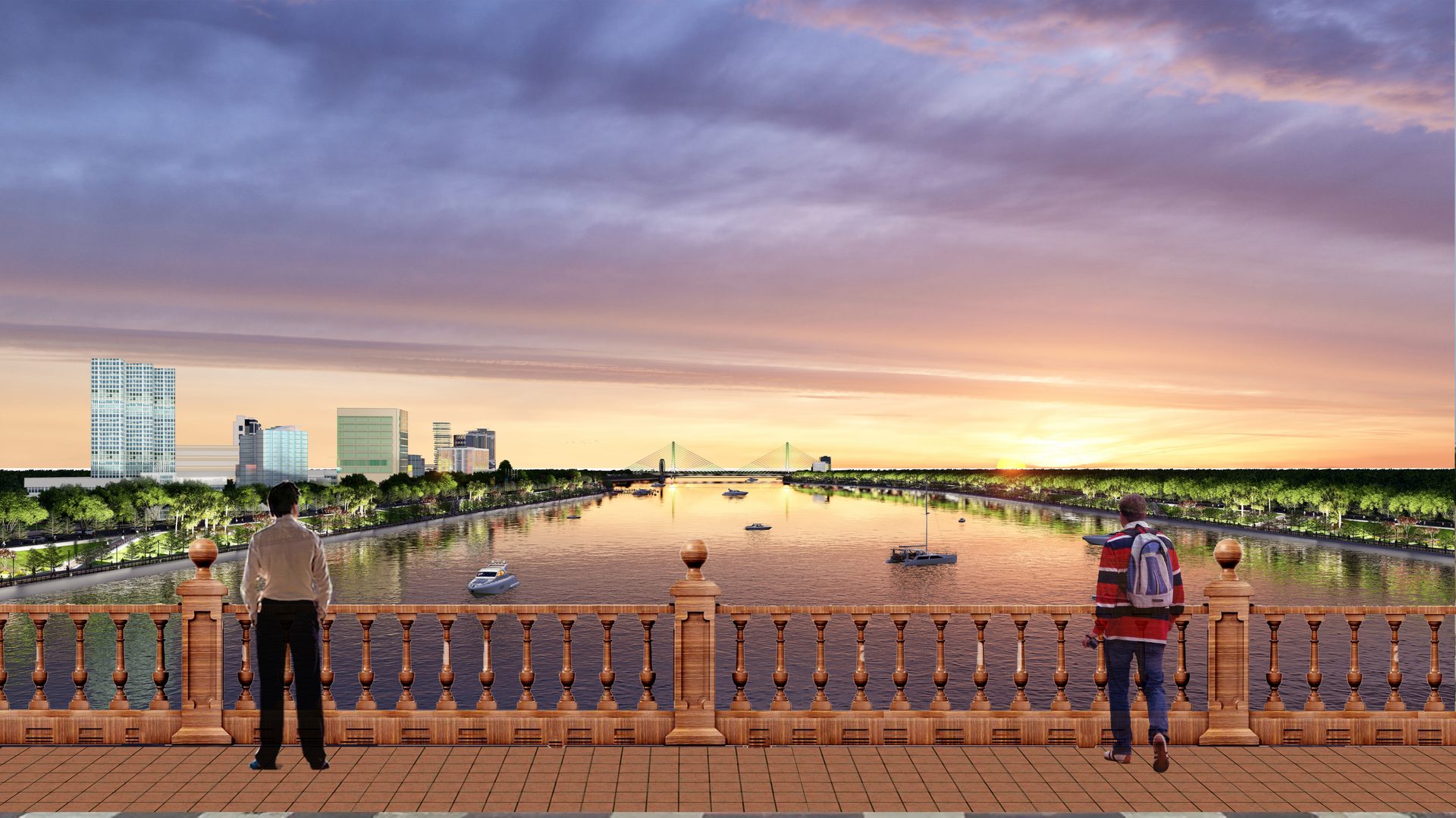
Riverfront Masterplan
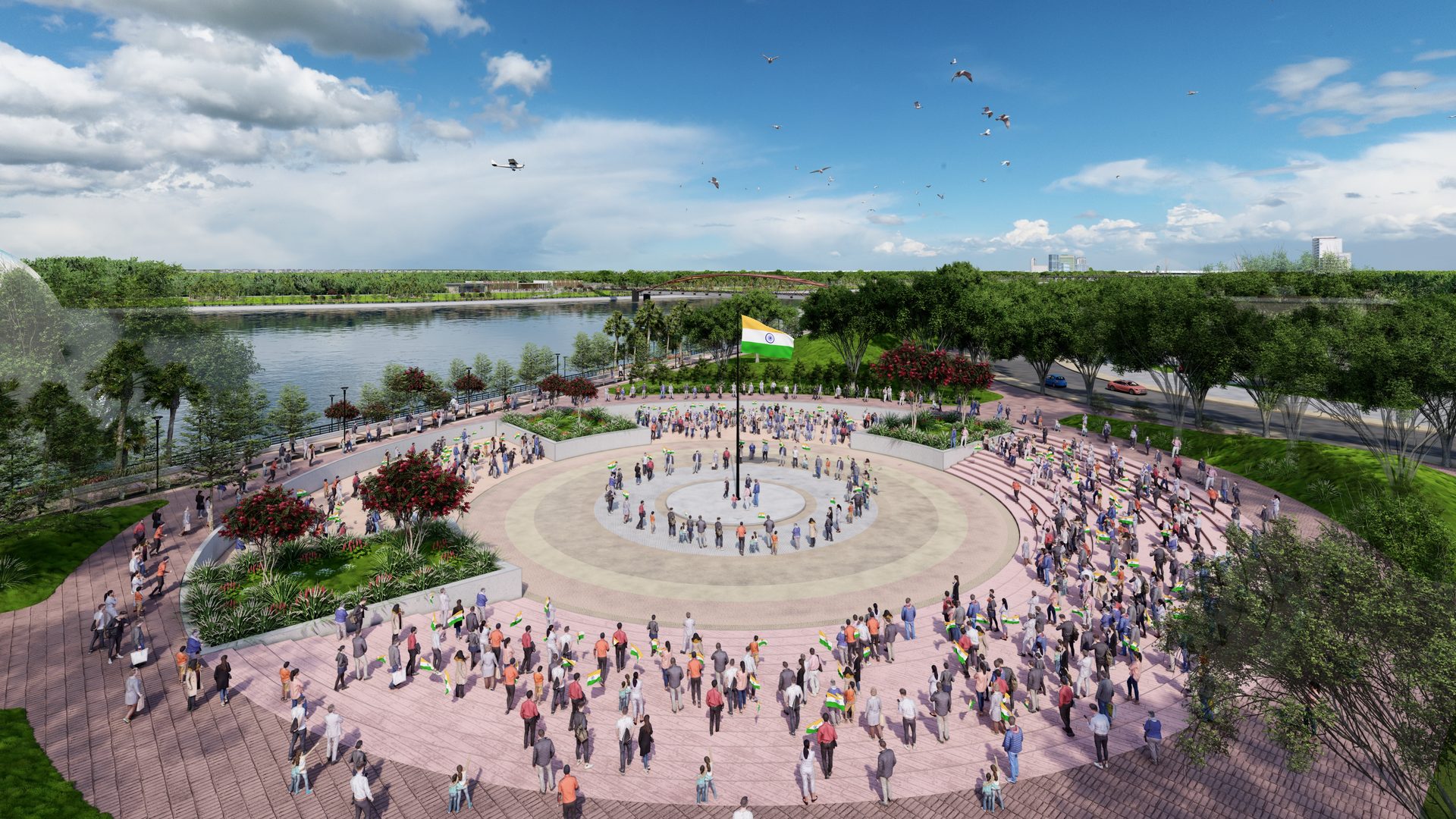
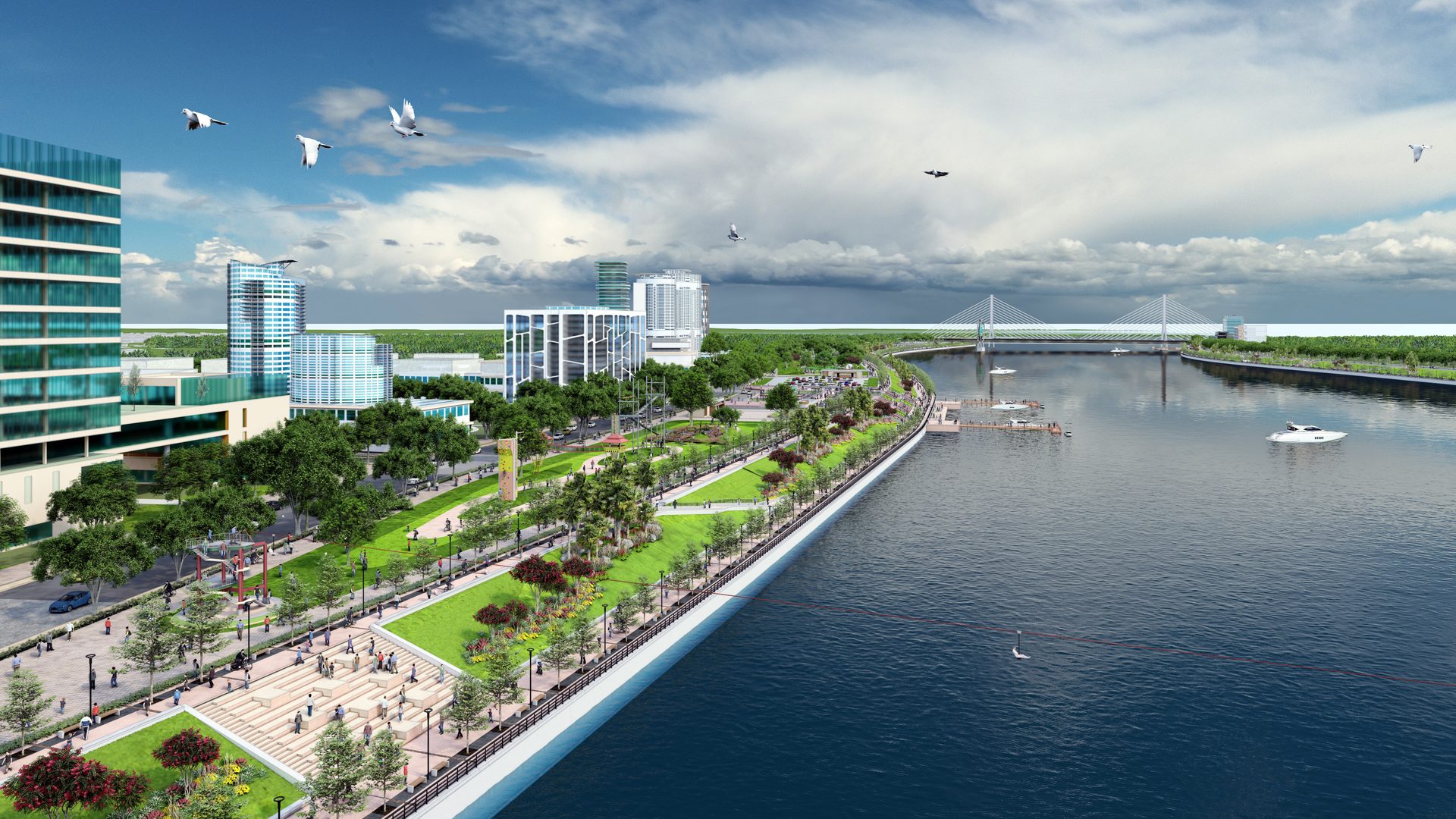
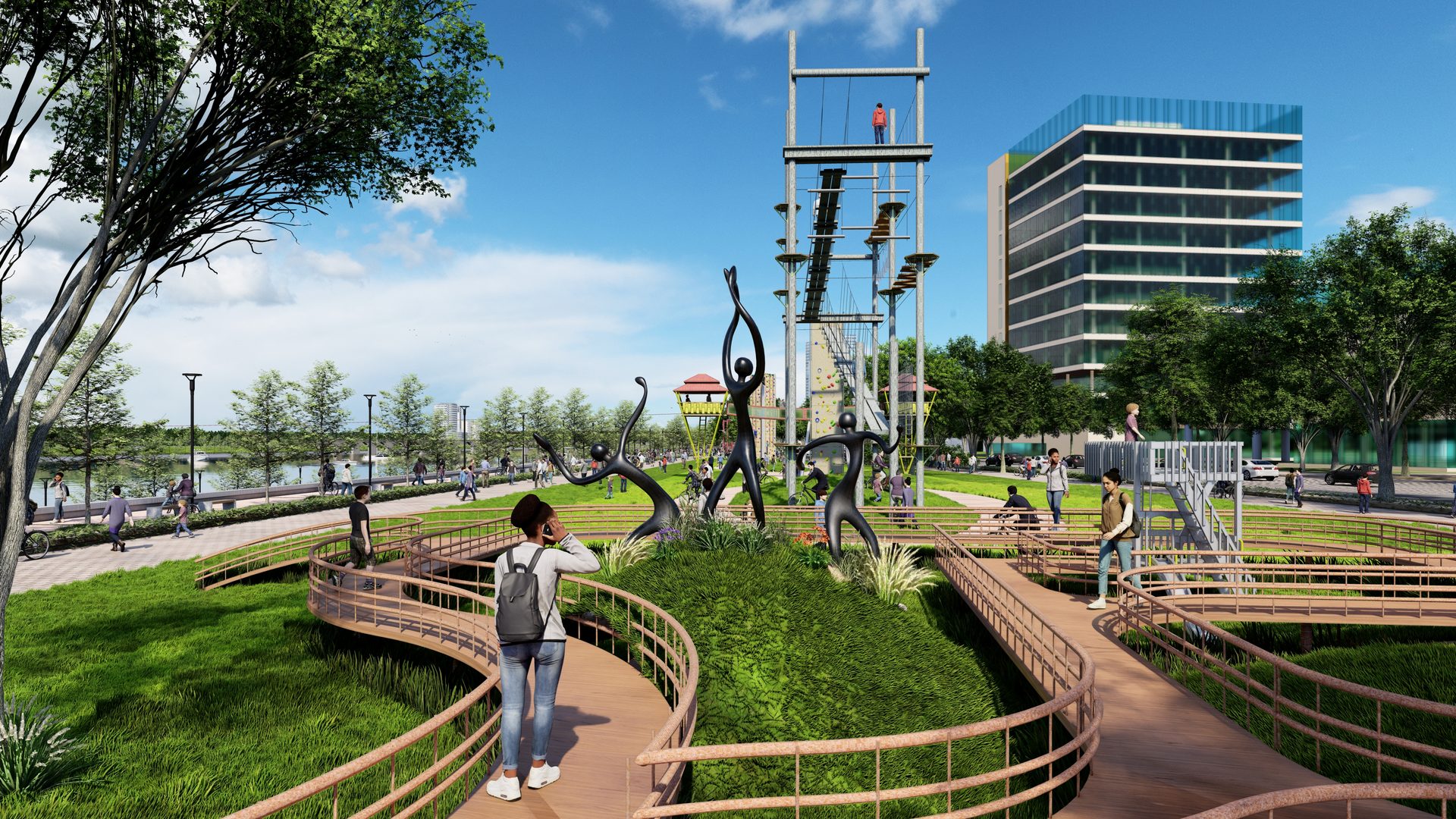
Transforming the Manair River edge into a continuous civic spine — a 10 km waterfront integrating recreation, mixed-use development, and tourism infrastructure with flood resilience built in.
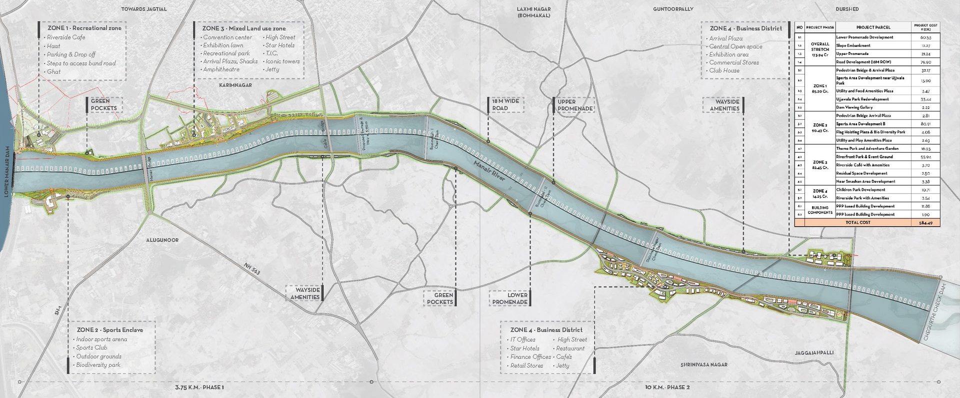
As Designer & 3D Visualization Lead, I contributed to the spatial framework for continuous public waterfront access along the Manair River, structuring a zoning strategy that integrates recreation, commercial, and civic functions.
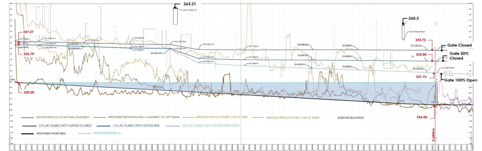
I developed the river-edge sections balancing flood control and public activation, coordinated with infrastructure and engineering consultants, and advanced the masterplan through stakeholder and municipal presentations with conceptual plans, sections, and 3D visualizations.
Four zones — Recreational, Sports Enclave, Mixed Land Use, and Business District — reposition the waterfront as a regional destination.